Join our annual celebration of local trails and parkland!
Santa Monica Mountains Trail Days is a time for individuals, families, and groups to give back to the parks by working together to maintain the trails. There’s an important task for everyone, from seasoned trail builders to first-time volunteers, as well as age-appropriate activities for children.
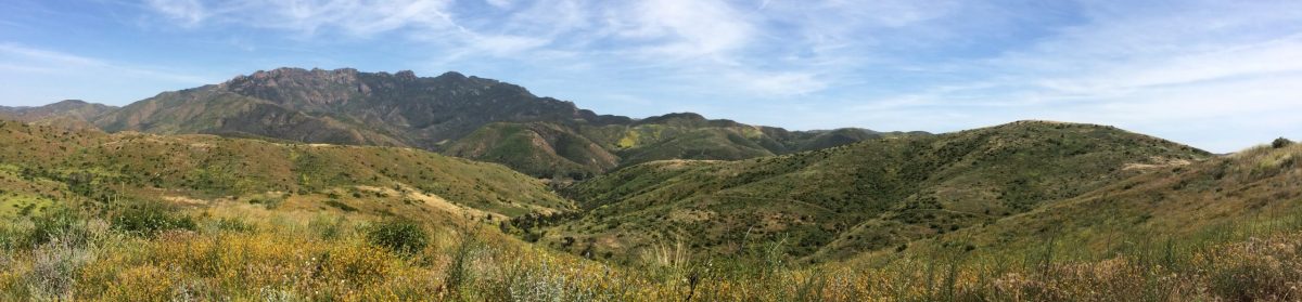
This year’s event will be held over the weekend of April 19th-21st (Friday-Sunday) at Danielson Group Campground in Point Mugu State Park. Registration is required.
Come out just for the day (Saturday or Sunday) to help clean up trails with the Sierra Club work party — or perhaps stay for the weekend, and enjoy a night or two of free camping, waking up both mornings to hot beverages and bagels. Volunteers can also look forward to a complimentary BBQ dinner on Saturday night, and a jumbo thank-you gift drawing on both days, generously sponsored by our organizers and community members.
(Event registration is handled by another of the organizing parties, the Santa Monica Mountains Trails Council, who will contact registrants directly).
Our slogan at the Sierra Club is “explore, enjoy and protect the planet.” For me, a big part of that involves animals and their own “enjoyment and protection.” Lord knows, right now they depend on us for protection.
As your Chair of the Santa Monica Mountains Task Force, I am an unapologetic tree-hugger and animal-lover. And there’s a lot of animals in the Santa Monica Mountains.
For many years, I have traveled around the world seeing animals in their natural environments. I have gone on numerous safaris to see lions, leopards, elephants, cape buffalo, zebras, giraffes and many others in their homes in East and Southern Africa. (I call it a “reverse zoo”: we humans are caged inside Land Rovers and safari vehicles, while the animals can go wherever they want.) I’ve tracked silverback gorillas in the jungles of Central Africa. Bird life, including red and blue-footed boobies in the Galapagos, and the iguanas and giant land tortoises there. Scuba-dived with bull sharks in Fiji, and great whites off Cape Town. I’ve witnessed the annual October migration of polar bears onto the sea ice of Hudson Bay, which was amazing and occurred before climate change had thinned out their population. Tigers in India and Thailand. Wolves, moose and grizzly bears in Denali National Park in Alaska.
Closer to home, we have four rescue Siamese cats, and I am “grandpa” to a feisty poodle mutt. So yes, I’m an animal-lover. And I live on the cusp between urban civilization and the “Great Wild” wilderness. My backyard sees coyotes, rattlesnakes, and very occasionally, mountain lions.
These animals have been in the news lately. We all know about P-22, the mountain lion hero of Griffith Park. For the first time, black bears are showing up in the Santa Monica Mountains (though tragically, the most recent one was struck and killed on the 101). Wolves have been seen migrating south from Oregon and the Rockies into NorCal—one got as far south as the Grapevine before being hit by a car. A litter of cougar cubs was just discovered in our mountains, despite the sickening number of cougars killed on our roads. The Annenberg Overpass over the 101 in Agoura, which this Task Force politically supported and contributed to financially, will hopefully help remediate that. Raptors, too: two peregrine falcons just had babies atop the Campanille Tower in Berkeley. Sadly, yesterday we just lost a highly publicized red-tailed hawk baby, which had been kidnapped and adopted by bald eagles.
At this Task Force, we have three major jobs: creating and maintaining many miles of hiking trails in the Santa Monica Mountains; organizing hikes of different levels and lengths to expose as many Sierra-Clubbers as possible to the beauty, majesty and wildlife of the Santa Monica Mountains; and political and legal activism to preserve the mountains from development and other threats, something we have accomplished in the courts, city hall and State Capitol.
I am proud and privileged to Chair this Task Force, and to work indefatigably toward those goals.
Eric Edmunds, Chair Santa Monica Mountains Task Force
On May 21st, the Sierra Club Angeles Chapter held its annual awards banquet. The large airy warehouse space near downtown Los Angeles, FRANKIE LA, saw currents of many chapter members moving from the bars and coffee stations to the auction tables to the big communal India ink mural to the banquet tables, where we sat for vegan BBQ and took in the awards celebrating the past year’s remarkable contributors to the ongoing vision of the Sierra Club.
Our resident Tuesday Moderate Hike leader, Ken Beauchene, won top honors with the Chester Versteeg Outings Service & Leadership Award, given for “long-term and outstanding leadership in furthering the enjoyment and safety of the outings program”.
As one nomination form aptly writes:
“Since 2015, Ken has led hundreds of the Task Force’s regular Tuesday, Backbone Trail, and Saturday hikes. During the early Covid era, but after the outings shut down ended, the leader supply chain was broken. Ken jumped in to lead some weekly groups that had been together for decades. As one hiker put it, ‘If Ken had not stepped up and led the Tuesday Moderate Hikers, it is not clear that the decades old group would have been able to continue their weekly hikes.’”
Santa Monica Mountains Trail Days is a beloved, free-to-attend annual celebration of our local trails and parkland. Held in Point Mugu State Park over the weekend of April 21st-23rd (Fri-Sun), it is a time for individuals, families, and groups to give back to the parks by working together to maintain the trails. There’s an important task for everyone, from seasoned trail builders to first-time volunteers, as well as age-appropriate activities for children.
We are proud to have been one of the festival’s founders, and it has continued to be the highlight of the SMMTF trail crew’s yearly schedule since its inception. Other organizing partners for the event include the Santa Monica Mountains Trails Council, California State Parks, National Park Service, and the Concerned Off-Road Bicyclists Association (CORBA).
Join us on Saturday, April 22nd (Earth Day) join us as we restore several recreational trails surrounding Danielson Group Campground at the 40th annual Santa Monica Mountains Trail Days — whether it’s with the Sierra Club work party (details) or another of the work crews — and perhaps stay for the weekend, and enjoy a night or two of free camping, waking up both mornings to hot beverages and bagels. Volunteers can also look forward to a complimentary BBQ dinner on Saturday night, and a jumbo thank-you gift drawing on both days, generously sponsored by our organizers and community members.
Registration is required.
Featured image by Jessy Lu
Sign up for Trail Days with the Sierra Club Trail Crew
To participate with the Sierra Club trail crew on Saturday, April 22nd, just send us an email (smmtaskforce@gmail.com) by April 17th with the following information for each registrant:
Name
Home address
Phone number (best number to reach you in emergency)
Emergency contact (name, phone number)
Camping on Friday night? yes/no
Camping on Saturday night? yes/no
Barbecue on Saturday night? yes/no meat/vegetarian
Additional trail work (with a non-Sierra Club crew) on Sunday? yes/no
A lot has been written about the late P-22, eloquently, and I can’t presume to add to that here. I do think public consciousness about pumas in the Santa Monica Mountains has increased exponentially in the last few weeks, and years. On February 4th there was a sold-out celebration of life at the Greek Theatre. The day prior, Congressman Adam Schiff (now running for Senator) formally requested the Postal Service to issue a stamp in P-22’s honor. February 4th’s L.A. Times featured a front-page, above-the-fold story headlined “Big Cats Suffer an Alarming Rate of Roadkills.” P-22, of course, was hit by a car before he had to be euthanized.
I have long been fascinated by mountain lions. They are among the most elusive creatures in the mountains you will ever (or never) see. In 46 years of trail-running and hiking, I have had only one encounter, if you can call it that. I was on an obscure trail in the Palisades Highlands, running down towards the coast, and 20 yards or so in front of me what looked like a dog-sized coyote emerged from the brush and trotted away. Except it didn’t have a furry bushy tail, it was a tubular tail. At once I realized this was no coyote. Whoa! I was taken aback!
Years ago, this Task Force made one of the first financial contributions to what is now the Wallis Annenberg Overpass on the 101 Freeway by Liberty Canyon. One of the first contributions. Let us hope and pray that, when completed, this will enable pumas, and other critters, to mix with genetic partners all the way up through the Los Padres National Forest, and promote the diversity of these endangered animals.
P-22 famously crossed two freeways, the 405 and the 101, to make it into Griffith Park, where it seems he had the whole turf to himself. And he was equally famously photographed with the Hollywood Sign in the background. Most are not so fortunate. When I open the morning paper and read about yet another puma-strike on one of our highways, I inwardly groan. Scientists say that if this trajectory doesn’t change, pumas may be extinct in these mountains in 50 years.
Someone once told the 1930s humorist Will Rogers that animals have no (human) “soul” and therefore cannot go to heaven. His response: “Well, I guess if animals can’t go to heaven, then when I die, I want to go where they go.”
Eric Edmunds, Chair Santa Monica Mountains Task Force
The Santa Monica Mountains Task Force is conducting a major fundraising drive to cover the expenses associated with the construction of the memorial bench and services for volunteer trail crew founder and friend, Ron Webster. We ask for your generous support.
Ron passed away in January, 2021, but public health concerns at the time prevented having a proper memorial honoring his more than 40 years of dedicated service to our community, hiking trails, and mountains.
Services will be held at Temescal Gateway Park on January 7th, 2023, followed by a short hike to the site of the memorial bench to be dedicated in Ron’s honor.
Give online
Donate securely with a debit or credit card, or directly from your PayPal account.
PayPal takes a merchant fee of 2.9% plus $0.30 from each online transaction.
Send a check
Checks (payable to “Santa Monica Mountains Task Force”) can also be mailed directly to our treasurer: Pam Smith, Santa Monica Mountains Task Force, 1872 Midvale Ave #107, Los Angeles, CA 90025.
Donations to the Santa Monica Mountains Task Force are not tax deductible.
At our August 2022 meeting, there was big news to report. Most of you know that years ago, the Santa Monica Mountains Task Force was the sole party to step up and sue The Edge (guitarist for the band U2) over his proposed five-mansion project in Sweetwater Mesa, Malibu, overlooking the Malibu Pier. It had been green-lighted by the Coastal Commission, so they were a party to the case, too. In a surprising turn of events, the Task Force won a victory in the California Court of Appeal which found the project had been improperly permitted.
There are some rich-and-famous folks who never hear the word “no”. The Edge pressed on and refused to sell the land (pristine ESHA) to an agency — despite a column from L.A. Times pundit Steve Lopez urging him to do so. Well, apparently, that has just changed, and The Edge has approached the Santa Monica Mountains Conservancy. Price and terms remain to be negotiated, but the fact he is now knocking on the door is encouraging. We have been asked to write letters in support of an acquisition. This happens to be a good time for the availability of State money.
Speaking of politics, we’re barreling toward a big election in November. Big for the environment, that is. Candidates of all stripes are running for an array of offices that affect the Santa Monica Mountains. Longtime staunch environmental activist Sheila Kuhl is termed out on the County Board of Supervisors, District 3, which includes a large chunk of the mountains (including The Edge’s property). Two candidates are running to replace her, one of whom, West Hollywood Councilwoman Lindsey Horvath, was our guest speaker earlier this month. L.A. City Council races in play include Districts 11, 4 and 5, which span big swaths of the mountains and hills. The politicians elected to these offices will be making, or influencing, many land-use decisions about development, fire policy, density and mansion-ization, among other things.
While the deadline has passed to submit a letter, the content of this petition, for those not in the know, is one of extreme importance.
As Los Angeles sees more push from developers threatening its fragile ecosystem and wildlife, this ordinance seeks to maintain wildland corridors and passages to ensure not only the protection of flora and fauna, but to help us battle fires and address the impacts of climate change.
Find here the Task Force’s letter of support for the ongoing effort to preserve wildlands and enhance wildland connectivity.
This video from LA This Week explains why Los Angeles needs a Wildlife Ordinance and how important it is for our ecosystem and environmental health.
Oak trees play a critical role in the ecosystem of the Santa Monica Mountains. 5000 species of insects, 150 birds, 105 mammals, 58 reptiles and amphibians, and 5 fish are dependent on oaks for their survival.
Often, following a wildfire or in response to combating climate change, there is a community response to plant trees in order to “do something”. Many areas of the mountains do not support trees, however, and some areas that do now may not in the future. It’s crucial to avoid indiscriminate tree planting in places where planting is not necessary or successful, and to focus restoration efforts in areas where trees can persist into the future.
The LA County Native Tree Priority Planting Plan is a coordinated effort by land managers and ecologists to consider the anticipated effects of climate change, and the recent impacts from the seven-year drought and Woolsey Fire, regarding restoring and expanding native oak and riparian woodlands within the Santa Monica Mountains National Recreation Area.
The plan articulates strategies to maintain biodiversity and resiliency of local trees and woodlands that provide critical habitat and linkage connectivity, as climate change creates significant stressors to their long-term survival.
During the trail crew’s off-season this summer, some of our volunteers spent a morning at Trippet Ranch in Topanga State Park with the Resource Conservation District of the Santa Monica Mountains, who have been working with CA State Parks to restore 10 acres of oak woodlands that were devastated during the last drought.
“Growing trees that will outlive us gives us a tangible, real action to take in the face of the myriad climate associated problems facing our planet,” said Rosi Dagit, Senior Conservation Biologist for the Resource Conservation District of the Santa Monica Mountains. “Planting them in places where they have a chance to live long lives means taking a thoughtful approach to our restoration efforts, and using the info we have to make the best possible choices so that the trees survive.”
• • •
DEVELOP is a NASA program which partners with organizations like the RCDSMM that are interested in integrating NASA Earth Science observations to inform their environmental decision making. The program addresses environmental and public policy issues through interdisciplinary research projects, building capacity in partner organizations to better prepare them to address the challenges that face our society and future generations around the globe.
Under this program, the Santa Monica Mountains Climate Team at JPL is using data collected by two airborne NASA Earth Observations (satellites) to isolate vegetation and monitor the changes to said vegetation over time.
UAVSAR (Uninhabited Aerial Vehicle Synthetic Aperture Radar) senses physical properties, and areas of vegetation are isolated by looking for rough or complex surface returns. AVIRIS (Airborne Visible / Infrared Imaging Spectrometer) measures over two hundred spectral bands, making it very sensitive to variations in spectral reflectance between the live and dead vegetation within these areas.
To learn more about how the NASA program informs the Native Tree Priority Planting Plan, watch this video (run time 3:00).
• • •
As we helped water and monitor the hundreds of young coast live oak (Quercus agrifolia) trees that were recently planted to mitigate for the loss experienced in the park, Rosi described the project as an “act of hope”, in reference to the fact that none of us will see these young trees reach maturity for ourselves.
At its August 17th, 2022 meeting, the State Board of Forestry and Fire Protection (BOF) unanimously approved the updated State Minimum Fire Safe Regulations. These regulations retain the identical road standards as in the 2020 regulations that we supported. They include minimum 20 foot wide roads, dead-end roads no longer than 800 feet to 1 mile, as well as many other specifications. The regulations apply to all residential, commercial, and industrial development in both the state responsibility area and in very high fire hazard severity zones in incorporated cities.
The BOF rejected the efforts during the past two years by the Rural County Representatives of California, Sonoma County, and the California Building Industry Association to gut the regulations. This would have encouraged development in dangerous fire-prone areas. This outcome would not have been possible without the participation of concerned individuals, grassroots and environmental organizations and our valued partners.
The BOF, as well as the California Attorney General’s Office, decisively confirmed that the regulations concerning access to a parcel being developed apply to all existing roads. The Exception process must follow strict requirements with material facts to demonstrate the Same Practical Effect as the State Fire Safe Regulations within a development perimeter. For substandard public roads needing improvement to meet the regulations, the public agency must determine whether the agency or the applicant will pay for the upgrade. If no upgrades are made, the development cannot proceed.
Thank you to SAFRR: State Alliance for Firesafe Road Regulations (our northern/southern CA Alliance) and all who joined the battle to ensure our fire fighters and evacuees will have the safest possible ingress and egress while navigating hillside roads during an emergency.